


Google Maps says the drive from Kampala to Bwindi takes about seven and a half hours. In practice, you should plan a full day, and often a bit more. We see the same surprise on almost every Uganda trip we set up.
This guide gives you real Uganda driving times and distances. First, you get one table with map times and real times side by side. Next, we walk through each route, from gorilla sectors to the Paraa ferry. Finally, you get simple rules for building a day plan that works.
Our team drives these roads with rental customers every month. So the times below come from the road, not just the screen.
Quick answer: Kampala to Bwindi takes 9 to 10 hours. Kampala to Murchison Falls (Paraa) takes 5.5 to 6.5 hours. Kampala to Queen Elizabeth (Mweya) takes 7 to 8 hours. Queen Elizabeth to Bwindi (Buhoma) via Ishasha takes 5 to 6 hours. Kigali to Bwindi (Rushaga) takes 4.5 to 5 hours. As a rule, add 30% to any Google Maps time.
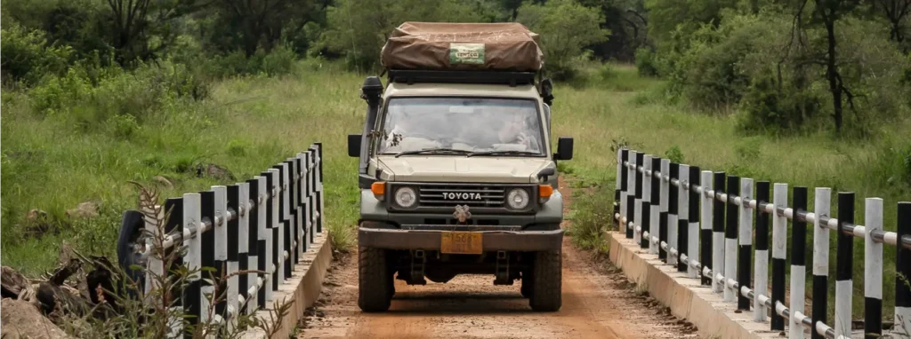
Uganda Driving Times and Distances Chart (km and Real Hours)
All times assume a loaded 4×4, dry roads and short stops only. Rows marked 🌧 slow down a lot in the rainy months.
Distances from Kampala and Entebbe
| Route | Distance | Google Maps time | Realistic time | Road type | Good overnight break |
|---|---|---|---|---|---|
| Entebbe Airport → Kampala centre | 40 km | 45 min | 1–1.5 h | Expressway + city | None needed |
| Kampala → Jinja | 80 km | 1.5 h | 2–3 h | Tarmac, heavy traffic | None needed |
| Kampala → Lake Mburo NP | 230 km | 3.5 h | 4–4.5 h | Tarmac, murram last 10–20 km | None needed |
| Kampala → Ziwa Rhino Sanctuary | 175 km | 3 h | 3–3.5 h | Tarmac | None needed |
| Kampala → Murchison Falls (Paraa) | 305 km | 5 h | 5.5–6.5 h | Tarmac to Masindi, then murram | Masindi or Ziwa |
| Kampala → Kibale NP (Kanyanchu) | 330 km | 5 h | 5.5–6.5 h | Tarmac via Mubende and Fort Portal | Fort Portal |
| Kampala → Queen Elizabeth NP (Mweya) | 420 km | 6.5 h | 7–8 h | Tarmac via Mbarara | Lake Mburo or Mbarara |
| Kampala → Lake Bunyonyi | 420 km | 6.5 h | 7–8 h | Tarmac via Mbarara and Kabale | Lake Mburo |
| Kampala → Bwindi (Buhoma) 🌧 | 470 km | 7.5 h | 9–10 h | Tarmac, then long murram section | Lake Mburo or Mbarara |
| Kampala → Bwindi (Rushaga) 🌧 | 510 km | 8 h | 9.5–10.5 h | Tarmac to Kabale, then mountain murram | Lake Mburo or Lake Bunyonyi |
| Kampala → Sipi Falls | 280 km | 4.5 h | 5–6 h | Tarmac via Jinja and Mbale | Jinja |
| Kampala → Kidepo Valley NP 🌧 | 590 km | 9.5 h | 11–13 h | Tarmac to Kitgum, then murram | Gulu (always split) |
Distances between national parks and key towns
| Route | Distance | Google Maps time | Realistic time | Road type |
|---|---|---|---|---|
| Lake Mburo → Bwindi (Buhoma) 🌧 | 280 km | 5 h | 6–7 h | Tarmac, then murram from Kihihi |
| Lake Mburo → Lake Bunyonyi | 200 km | 3.5 h | 3.5–4 h | Tarmac |
| Lake Bunyonyi → Bwindi (Rushaga) 🌧 | 55 km | 1.5 h | 2 h | Steep murram |
| Kabale → Bwindi (Ruhija) 🌧 | 50 km | 1.5 h | 2 h | Steep murram |
| Kisoro → Bwindi (Nkuringo) 🌧 | 35 km | 1 h | 1.5 h | Mixed, hilly |
| Bwindi (Buhoma) → Bwindi (Ruhija) 🌧 | 45 km | 1.5 h | 2–3 h | Forest murram |
| Bwindi (Buhoma) → Ishasha (QENP) 🌧 | 65 km | 1.5 h | 2–3 h | Murram |
| Ishasha → Mweya (QENP) 🌧 | 100 km | 2 h | 2.5–3 h | Park track, then tarmac |
| Mweya (QENP) → Kibale (Kanyanchu) | 150 km | 3 h | 3.5–4 h | Tarmac via Kasese and Fort Portal |
| Fort Portal → Semuliki (Sempaya) | 60 km | 1.5 h | 1.5–2 h | Winding tarmac and murram |
| Kibale (Kanyanchu) → Murchison (Paraa) | 330 km | 5.5 h | 6.5–7.5 h | Tarmac via Hoima, murram in the park |
| Murchison (Paraa) → Gulu | 130 km | 2.5 h | 3–3.5 h | Park murram, then tarmac |
| Gulu → Kidepo (Apoka) 🌧 | 260 km | 5 h | 6–7 h | Tarmac to Kitgum, then murram |
| Sipi Falls → Moroto | 200 km | 3.5 h | 4–5 h | Tarmac, some rough patches |
| Moroto → Kidepo (Apoka) 🌧 | 220 km | 4.5 h | 5.5–6.5 h | Murram via Kotido and Kaabong |
Why Uganda Drives Take Longer Than the Map Says
Uganda’s roads look short on a map. However, several small things add up over a long day.
First, leaving Kampala alone can take one to two hours. Traffic backs up on every main exit, especially on weekday mornings. Next, most highways pass through busy trading centres. Each one has speed bumps, market stalls and people crossing. On top of that, the last stretch to most parks is murram (red dirt road). It’s slower, dustier and bumpier than tarmac.
Then add the smaller delays. Boda bodas weave through traffic, and cattle cross the road. You’ll also stop for fuel, lunch and the odd police check.
Our rule of thumb: multiply the Google Maps time by 1.3 in the dry season. In the wet season, multiply it by 1.5. For the full picture on road surfaces, rules and traffic, read our guide to driving in Uganda.
Driving to Bwindi: Times by Gorilla Sector
Bwindi is not one destination. In fact, it has four gorilla trekking sectors, and they lie hours apart by road. So the sector printed on your permit decides your route, your lodge and your drive time.
Buhoma (north)
Buhoma is the easiest sector to reach from the north and from Queen Elizabeth. From Kampala, the usual route goes via Mbarara, Rukungiri and Kihihi. That’s about 470 km and 9 to 10 hours. We recommend you split it with a night at Lake Mburo.
From Queen Elizabeth, you drive south through the Ishasha sector. This adds a game drive to your transfer day. From Kihihi airstrip, Buhoma is about 1 to 1.5 hours away.
Ruhija (east)
Ruhija is the highest sector, at around 2,300 m. From Kabale, it takes about two hours on a steep murram road. The road from Buhoma to Ruhija crosses a forest stretch called “the neck”. It’s beautiful but slow, and it gets slippery after rain.
Rushaga and Nkuringo (south)
These two southern sectors are closest to Rwanda. From Kigali, you cross at Cyanika and reach Rushaga in about 4.5 to 5 hours. From Kabale or Lake Bunyonyi, allow about two hours.
Nkuringo is about 1.5 hours from Kisoro town on a hilly road. Many travellers use Lake Mutanda or Lake Bunyonyi as a relaxed base for both sectors.
Moving between sectors
| From → To | Realistic time |
|---|---|
| Buhoma → Ruhija | 2–3 h |
| Ruhija → Rushaga | 2–2.5 h |
| Rushaga → Nkuringo | 1.5–2 h |
| Buhoma → Rushaga | 4–5 h |
Our advice: sleep near your sector the night before your trek. Check-in at the trekking briefing usually starts around 7:30 am. So never plan a long drive on the morning of your trek. For permits and trekking details, see our gorilla and chimpanzee trekking guide.
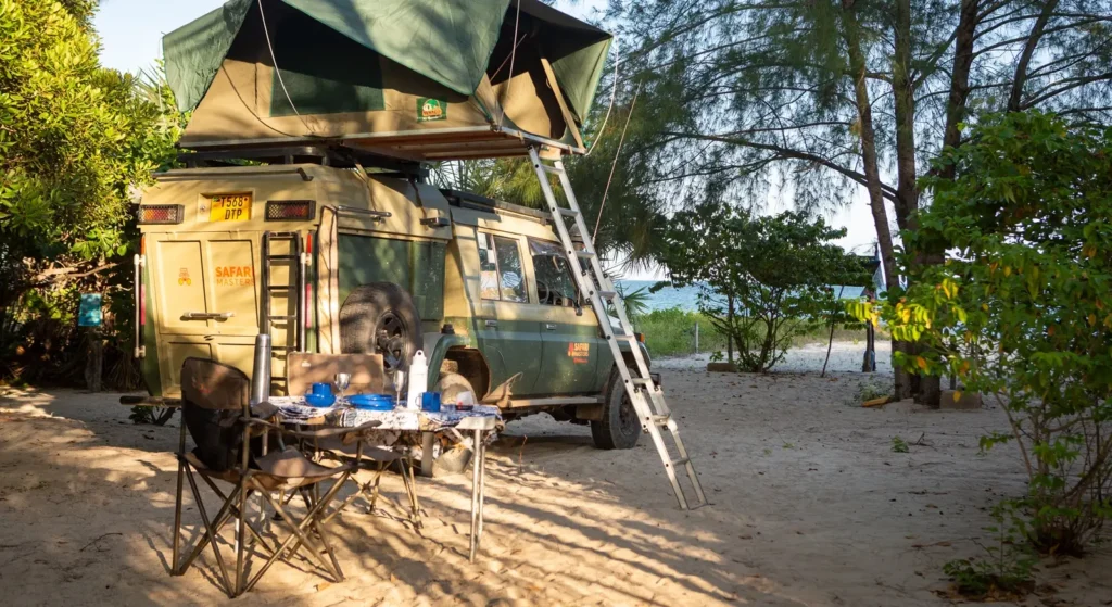
Southwest Routes: Lake Mburo, Bwindi and Lake Bunyonyi
Kampala to Lake Mburo
This is the classic first-day drive out of Kampala. It’s about 230 km, and it takes 4 to 4.5 hours. On the way, you cross the Equator at Kayabwe, about 72 km from Kampala. It’s a good spot for a coffee and a photo.
Masaka and Mbarara both have reliable fuel stations. Lake Mburo is also the smartest place to break the long drive to Bwindi.
Lake Mburo to Bwindi
For Buhoma, head to Mbarara, then go via Ntungamo, Rukungiri and Kihihi. The last part is murram, so budget 6 to 7 hours in total. For the southern sectors, drive via Kabale instead.
Bwindi to Lake Bunyonyi and Lake Mutanda
From Rushaga, Lake Bunyonyi is about two hours away, and Lake Mutanda is closer still. Both lakes make a calm rest stop after trekking. Moreover, they break up the drive back north.
Bwindi (Buhoma) to Queen Elizabeth via Ishasha
This is one of our favourite transfer days. You leave Buhoma, drive about 65 km to Ishasha, and search for tree-climbing lions on the way. Then you continue about 100 km north to Mweya. Plan 5 to 6 hours in total, including a slow game drive.
Warning: the Ishasha road gets very muddy in the rainy season, and bridges sometimes wash out. Ask us about current conditions before you set off.
Western Routes: Queen Elizabeth, Kibale, Fort Portal and Semuliki
Kampala to Fort Portal and Kibale
The direct route goes west via Mubende. It’s about 300 km of tarmac to Fort Portal, which takes around 5 to 5.5 hours. From Fort Portal, the Kanyanchu visitor centre in Kibale is about 35 km south. Allow 45 minutes to an hour.
Queen Elizabeth (Mweya) to Kibale (Kanyanchu)
Most drivers go via Kasese and Fort Portal on good tarmac. The drive covers about 150 km and takes 3.5 to 4 hours. On the way, the crater lakes near Fort Portal make a great lunch stop.
Kibale to Semuliki (Sempaya)
The Sempaya hot springs lie about 60 km from Fort Portal. The road winds over the Rwenzori foothills, so give it 1.5 to 2 hours. After heavy rain, this road can be slow.
Northern Routes: Ziwa, Murchison Falls and Kidepo
Kampala to Ziwa Rhino Sanctuary and Murchison Falls
Head north on the Gulu road. Ziwa Rhino Sanctuary is about 175 km from Kampala, and rhino tracking there breaks the drive nicely. From there, continue to Masindi, your last big fuel stop.
After Masindi, you enter the park at Kichumbanyobo gate and drive down to Paraa. In total, Kampala to Paraa is about 305 km and 5.5 to 6.5 hours.
The Paraa ferry: plan your arrival around it
The Victoria Nile splits Murchison Falls in two. Most game drives happen on the north bank, while many lodges and campsites are on the south bank. A small vehicle ferry at Paraa links the two.
The ferry crosses about every hour. Park sources list the first crossing around 7 am and the last around 7 pm. It carries only a few vehicles at once, so queues build up at busy times.
Our advice: aim to reach Paraa by 5 pm at the latest. If you miss the last crossing, you’re stuck on the wrong side for the night. Also, confirm the latest ferry times at the park gate. You can also check park news on the Uganda Wildlife Authority website.
Kibale or Fort Portal to Murchison
You don’t need to go back through Kampala. Instead, drive north via Hoima and enter Murchison from the south-west. It’s about 330 km and 6.5 to 7.5 hours. Start early, and fill up in Hoima.
Kampala to Kidepo Valley
Kidepo is Uganda’s most remote park, about 590 km from Kampala. There are two main routes:
- Via Gulu and Kitgum: the most common route. We always split it with a night in Gulu.
- Via Mbale and Moroto: a good choice if you’re coming from Sipi Falls. Plan a night in Moroto.
Either way, don’t try Kampala to Kidepo in one day. After Kitgum or Kotido, the roads turn rough and the towns thin out. If you’re short on time, consider flying one way to the Kidepo airstrip.
Eastern Routes: Jinja, Sipi Falls and Mbale
Kampala to Jinja
Jinja is only about 80 km away. Even so, traffic makes it a 2 to 3 hour drive. The government plans a new Kampala–Jinja Expressway, but it isn’t open yet. So leave early, or avoid rush hour.
Jinja to Sipi Falls via Mbale
From Jinja, the road passes through Iganga and Tororo to Mbale. Then you climb about 55 km up to Sipi on the slopes of Mount Elgon. The full drive takes about 4 hours. Kampala to Sipi takes 5 to 6 hours in one go.
Sipi Falls to Kidepo via Moroto
This is a big two-day journey through Karamoja. Drive Sipi to Moroto on day one, which takes 4 to 5 hours. Then continue to Kidepo via Kotido and Kaabong on day two, which takes 5.5 to 6.5 hours. Fuel up in Moroto, and carry extra water.
Cross-Border Drive Times: Rwanda and Kenya
Kigali to Bwindi and Lake Bunyonyi
Many of our guests fly into Kigali because it’s so close to southern Bwindi. There are two useful border posts:
- Cyanika (Kisoro side): best for Rushaga, Nkuringo and Lake Mutanda. Kigali to Rushaga takes about 4.5 to 5 hours.
- Katuna/Gatuna (Kabale side): best for Lake Bunyonyi, Ruhija and Buhoma. Kigali to Lake Bunyonyi takes about 3 to 3.5 hours.
Rwanda’s roads are smooth and well signposted. However, the border itself can take one to two hours. For passports, visas and car documents, see our Uganda entry requirements guide.
Uganda to Kenya
The main crossings are Busia and Malaba, both about 200 km east of Kampala. From there, Nairobi is roughly another full day of driving. For the Kenyan side, read our Kenya road distances guide.
Remember: you need a cross-border permit to take a rental 4×4 out of Uganda. Tell us early, and we’ll arrange it with your 4×4 rental.
Driving Times Inside the National Parks
Many travellers forget one thing: the drive doesn’t end at the park gate. Inside the park, you still drive to your camp and then go on game drives.
| Park | Gate → main camp or lodge area | Typical game drive |
|---|---|---|
| Murchison Falls | Kichumbanyobo gate → Paraa: about 1 h | North bank loop: 3–4 h |
| Queen Elizabeth | Katunguru → Mweya: about 30 min | Kasenyi plains: 2–3 h |
| Queen Elizabeth (Ishasha) | Ishasha gate → lion area: about 30 min | Ishasha loop: 2–3 h |
| Kidepo Valley | Park entrance → Apoka: about 1 h | Narus Valley: 2–3 h |
| Lake Mburo | Nshara gate → Rwonyo: about 30 min | Park loop: 2–3 h |
Also, keep to the park speed limits. They protect the animals, and rangers do enforce them. Our driving in Uganda guide lists the rules.
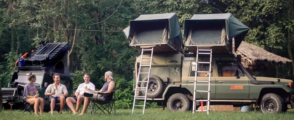
How Far Should You Drive in One Day?
We plan every self-drive route with a few simple limits:
- Aim for 5 to 6 hours of driving a day. That’s about 300 km on mixed roads. A few transfer days take longer, so start those early.
- Arrive before dark. Most park gates close at 7 pm, and night driving isn’t safe. Read more in our guide on whether Uganda is safe.
- Stay two nights per stop where possible. It gives you a full day to enjoy each place.
- No long drives on trek days or flight days. A delay could cost you a permit or a flight.
- Start early. A 7 am departure beats the traffic and the afternoon rain.
Where to break the long drives
| Long drive | Best place to stop overnight |
|---|---|
| Kampala → Bwindi (Buhoma) | Lake Mburo or Mbarara |
| Kampala → Bwindi (Rushaga) | Lake Mburo or Lake Bunyonyi |
| Kampala → Queen Elizabeth | Lake Mburo or Mbarara |
| Kampala → Murchison Falls | Ziwa or Masindi |
| Kampala → Kidepo | Gulu |
| Sipi Falls → Kidepo | Moroto |
| Kibale → Murchison Falls | Hoima |
Sample Route Plans with Daily Driving
These plans show driving only. For full day-by-day trips, see our Uganda self-drive itineraries.
7-day southwest loop
| Day | Drive | km | Time |
|---|---|---|---|
| 1 | Entebbe → Lake Mburo | 250 | 4.5–5 h |
| 2 | Lake Mburo (game drive) | 30 | 2–3 h |
| 3 | Lake Mburo → Lake Bunyonyi | 200 | 3.5–4 h |
| 4 | Lake Bunyonyi → Bwindi (Rushaga) | 55 | 2 h |
| 5 | Gorilla trek, no transfer | 0 | 0 |
| 6 | Rushaga → Lake Mburo | 250 | 5–5.5 h |
| 7 | Lake Mburo → Entebbe | 250 | 4.5–5 h |
10-day classic loop
| Day | Drive | km | Time |
|---|---|---|---|
| 1 | Entebbe → Ziwa → Murchison | 340 | 6.5–7 h |
| 2 | Murchison (game drive and boat) | 60 | 3–4 h |
| 3 | Murchison → Kibale via Hoima | 330 | 6.5–7.5 h |
| 4 | Kibale (chimp tracking) | 20 | 1 h |
| 5 | Kibale → Queen Elizabeth | 150 | 3.5–4 h |
| 6 | Queen Elizabeth (game drive) | 60 | 3 h |
| 7 | Mweya → Ishasha → Bwindi (Buhoma) | 165 | 5–6 h |
| 8 | Gorilla trek, no transfer | 0 | 0 |
| 9 | Bwindi → Lake Mburo | 280 | 6–7 h |
| 10 | Lake Mburo → Entebbe | 250 | 4.5–5 h |
14-day full circuit
Start with the 10-day loop. Then add three days for Jinja and Sipi Falls in the east. Finally, add one extra day in Bwindi. Alternatively, swap the east for Kidepo, but only with a night in Gulu on each leg.
How the Rainy Season Changes Drive Times
Tarmac roads stay reliable all year. Murram roads, however, can turn to thick mud within hours. Here are the routes we watch most closely:
| Route | Extra time in heavy rain |
|---|---|
| Buhoma → Ishasha → Mweya | +1–3 h, sometimes impassable |
| Buhoma → Ruhija (“the neck”) | +1–2 h |
| Kabale / Kisoro → Rushaga and Nkuringo | +1 h |
| Kitgum or Kotido → Kidepo | +2–3 h |
| Fort Portal → Semuliki | +1 h |
| Mbale → Sipi Falls | +30–60 min |
For the rainy months and the best travel windows, see the best time to visit Uganda.
Fuel Stops on Long Routes
Fuel is easy to find in big towns. After that, stations get scarce, and some may not have diesel. So fill up at every major town.
| Route | Last reliable fuel | Notes |
|---|---|---|
| Kampala → Murchison | Masindi | No fuel inside the park |
| Kampala → Bwindi (Buhoma) | Rukungiri or Kihihi | Small stations only near Buhoma |
| Kampala → Bwindi (south) | Kabale or Kisoro | Nothing near Rushaga or Nkuringo |
| Queen Elizabeth | Kasese or Katunguru | Katunguru supply varies |
| Kibale → Murchison | Hoima | Long stretch after Hoima |
| Kampala → Kidepo | Kitgum or Kotido | Carry a jerrycan past here |
| Sipi → Kidepo | Moroto | Very few stations in Karamoja |
For payment tips at the pump, check our driving in Uganda guide.
Should You Drive or Fly?
Driving gives you freedom, and the scenery is half the fun. Still, flying makes sense in two cases.
The first is Kidepo, where a flight saves two long days. The second is a short trip with gorilla trekking. Domestic flights land at Kihihi (for Buhoma), Kisoro (for the south), Pakuba (Murchison), Kasese (Queen Elizabeth) and Kidepo.
On a self-drive trip, though, you collect the car at the start. So most of our guests drive the whole loop and fly only for Kidepo.
Frequently Asked Questions
How long is the drive from Kampala to Bwindi?
Plan 9 to 10 hours for the roughly 470 km to Buhoma. The southern sectors take a little longer. Google Maps shows about 7.5 hours, but traffic, towns and murram roads slow you down. We recommend a night at Lake Mburo on the way.
How long is the drive from Entebbe to Bwindi?
It takes about the same as from Kampala, 9 to 10.5 hours. You can skip central Kampala by taking the Entebbe–Mpigi road towards Masaka. Even so, split the drive if you can.
How far is Murchison Falls from Kampala?
Paraa, in the heart of Murchison Falls, is about 305 km from Kampala. The drive takes 5.5 to 6.5 hours via Masindi. Stop at Ziwa Rhino Sanctuary to break it up.
How long does it take to drive from Queen Elizabeth to Bwindi?
From Mweya to Buhoma via Ishasha, allow 5 to 6 hours. That includes a slow game drive through Ishasha. In heavy rain, the Ishasha road can get much slower.
How long is the drive from Kigali to Bwindi?
Kigali to Rushaga takes about 4.5 to 5 hours via the Cyanika border. Kigali to Buhoma takes longer, about 6 to 7 hours via Katuna and Kabale. Border checks add one to two hours.
Can you drive from Kampala to Kidepo in one day?
You can, but we don’t recommend it. The 590 km drive takes 11 to 13 hours. Instead, stay a night in Gulu, or fly one way.
Do you need a 4×4 to drive between Uganda’s national parks?
Yes. Most park roads and many access roads are murram, and they turn muddy in the rain. A 4×4 also gives you better clearance and grip on steep Bwindi roads. See our driving in Uganda guide for more.
Plan Your Uganda Route with Us
Every Safari Masters rental comes with route advice from our team. We’ll check your drive times, flag rain-affected roads and suggest the best overnight stops.